Two Centuries of Economic and Public Health Evolution Along Upstate New York's Greatest Waterway
Description:
The Erie Canal, completed in 1825, transformed upstate New York from a frontier into an industrial and commercial powerhouse — and its legacy continues to shape the region today. This interactive map traces that 200-year story through two lenses: the rise and fall of industry along the canal corridor, and the growth of healthcare infrastructure that followed in its wake.
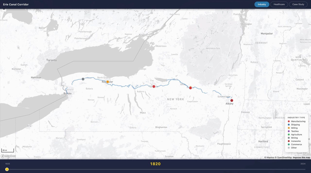 Industry Mode plots 30 curated historical sites — iron foundries, textile mills, grain elevators, shipping terminals — color-coded by type. Use the timeline slider to watch manufacturing spread westward in the canal's early decades, peak in the late 19th century, and contract through deindustrialization by the late 20th century.
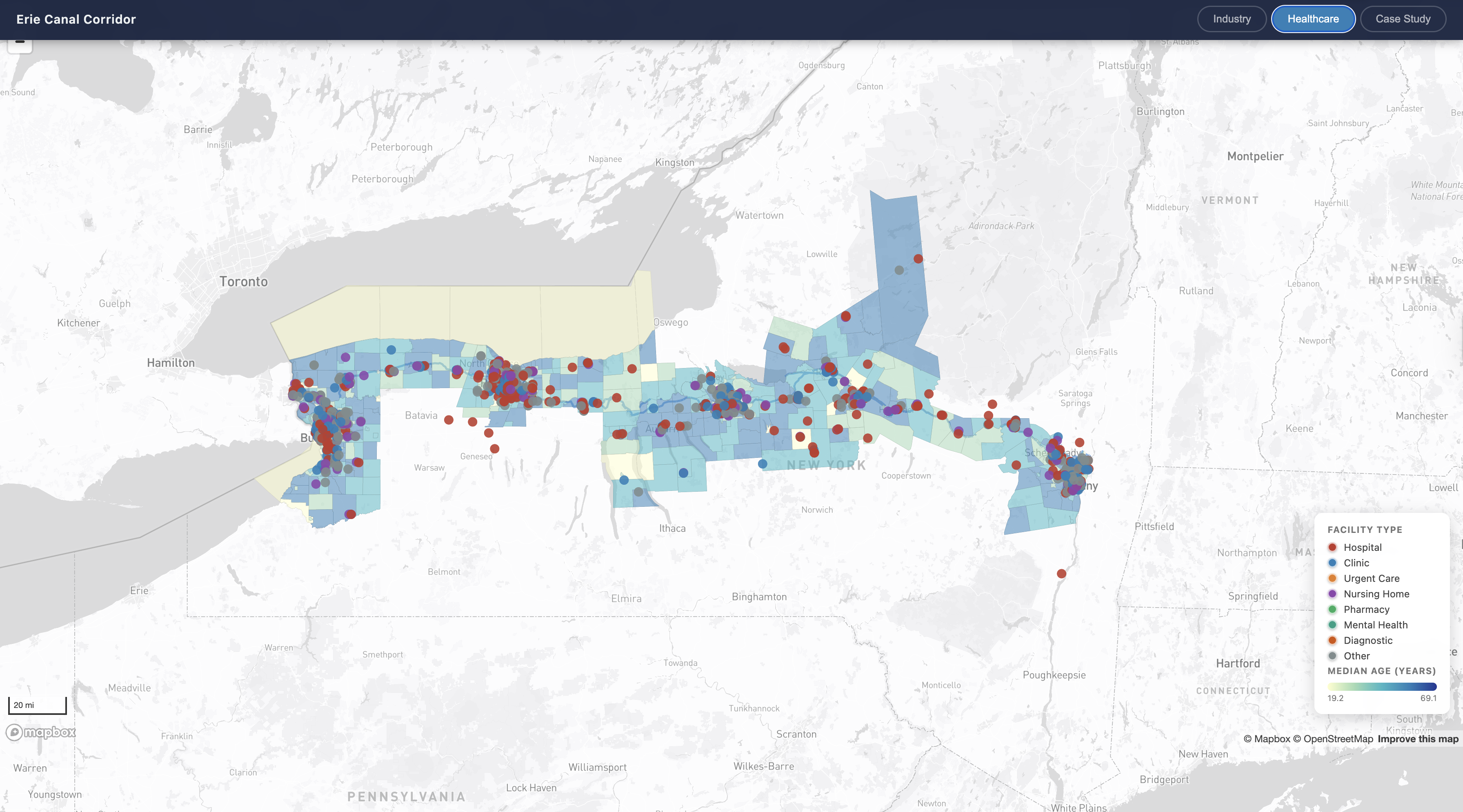
Healthcare Mode shows licensed health facilities across 14 corridor counties today, layered over Census demographic data. Toggle the choropleth to shade counties by median age, household income, or population density — revealing how today's health landscape maps onto the region's uneven economic legacy.
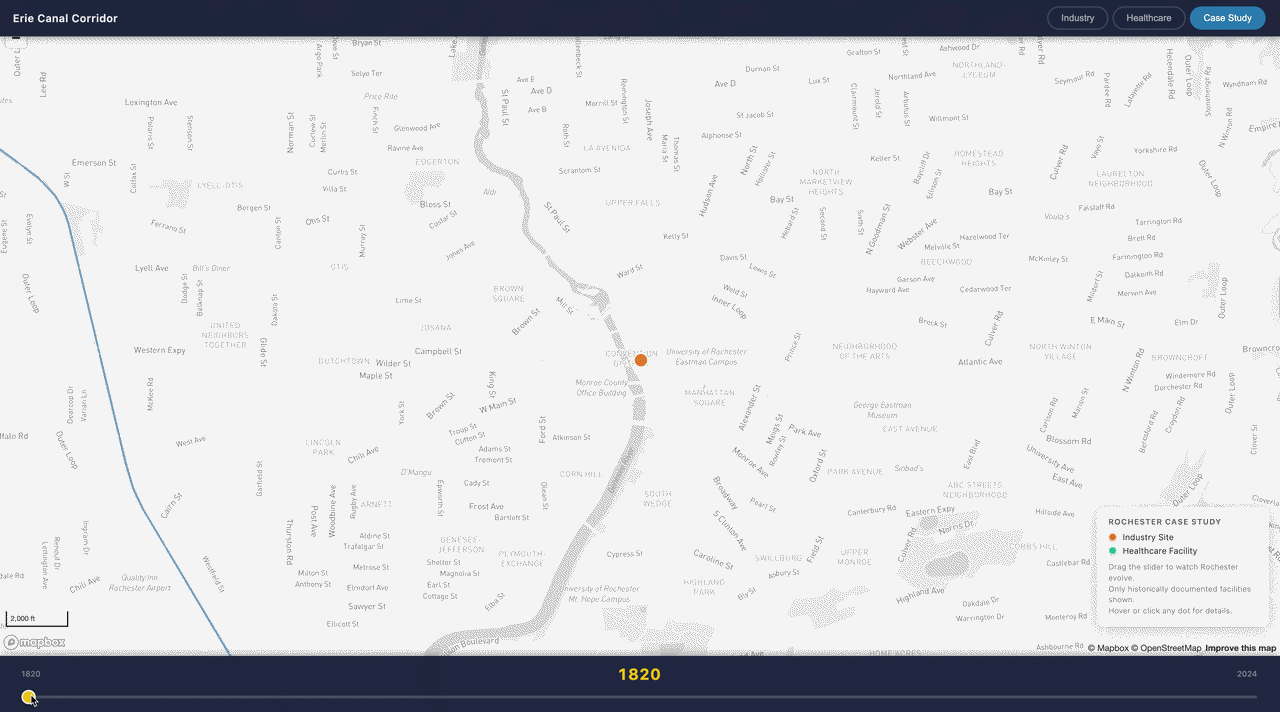 Case Study: Rochester zooms into Monroe County to tell both stories simultaneously. Watch industry establish itself along the Genesee River in the 1820s, give rise to iconic firms like Eastman Kodak and Bausch & Lomb, and gradually decline — while healthcare institutions like Rochester General Hospital (1847), Highland Hospital (1889), and the Eastman Dental Center (1917) emerge and expand in their place. Only facilities with verified historical founding dates are shown, so every dot that appears on the map is historically documented.
Works Cited
Data Sources
| Dataset | Description | Source |
|---|---|---|
| NYS Health Facility Registry | Licensed health facilities across New York State, including facility type, location, and certification dates | health.data.ny.gov |
| U.S. Census Bureau — ACS 5-Year Estimates (2022) | Tract-level demographics: median age, median household income, total population | census.gov/programs-surveys/acs |
| U.S. Census Bureau — TIGER/Line Shapefiles (2022) | Census tract boundary geometries for corridor counties | census.gov/geographies/mapping-files/time-series/geo/tiger-line-file.html |
| OpenStreetMap via Overpass API | Erie Canal centerline geometry | overpass-api.de · © OpenStreetMap contributors (ODbL) |
| National Register of Historic Places | Historical industrial site records, designations, and descriptions | nps.gov/subjects/nationalregister |
| Rochester healthcare institutional histories | Verified founding years from hospital history pages, Wikipedia, NYS DOH records, and news archives | Rochester Regional Health Archives · URMC · Wikipedia |